Reconstructed Census Geography GIS layers
For each census year, a series of boundary polygon files are provided. These boundary polygon files reconstruct the census compilation and dissemination geography of that year. GIS layers are provided to users in ESRI “shape file” format. Files are provided for each province at the Census subdivision (CSD) level of geography, and for the entire country at the Census division (CD) level of geography.
In addition, CCRI REFERENCE MAPS of each province showing CSD and CDs for each census year, referenced by CCRIUID, are available in PDF file format (see list below).
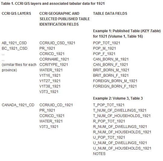
These GIS layers can be used in two ways: first, they can be used independently (with the attribute data fields included in the files); second, they can be used by joining to other tabular data based on a linking field. The primary identification fields for each polygon are included in each of these files, which enables them to be linked to the microdata. This also allows linking to published tables data files. In addition, attribute fields containing the data from the KEY published table are included, so that basic data, such as total population, can be mapped without linking to any external tables. For more details, see Using the Geographic Component of the CCRI.
Using the example of 1921, the files and their associated tabular data are as follows.
Table 1. CCRI GIS layers and associated tabular data for 1921